
Glacial till → Mudstone
Alluvial gravel → Sandstone
Made ground → Clay → Rock
Dense sand → Limestone
Know What's
Beneath Before
You Build.
Stratum drives drill rigs into the ground, pulls core samples from bedrock, and translates what the earth is hiding into reports that determine whether a building stands or a slope fails.
400+
Sites Drilled
12.5m
Avg. Depth
48h
Quote Turnaround
Full-spectrum ground
investigation services.
From the initial desk study through to the final interpretive report, every phase of a Stratum investigation is carried out by chartered geotechnical engineers — not subcontracted to unknown crews.
Rotary Core Drilling
Diamond-tip barrel through boulders and broken rock. RQD logged to ASTM D6032.
Enquire →Hollow-Stem Auger
SPT N-values at 1.0 m intervals. Disturbed and Shelby tube samples. Suitable for most soils.
Enquire →Environmental Boreholes
Contaminated land investigation, groundwater monitoring wells, soil vapour probes to EA standards.
Enquire →Sonic Drilling
High-frequency vibration. Minimal ground disturbance. Ideal for urban sites and near wetlands.
Enquire →Ground-truth begins
before the rig moves.
We review British Geological Survey maps, historical Ordnance Survey sheets, mining records, and Environment Agency flood-risk data. Desk study narrows the unknown before a single metre is drilled — reducing cost and eliminating surprises.
Sources reviewed
per site before mobilisation
Every borehole
justified on paper first.
The rig goes in.
Nothing is assumed.
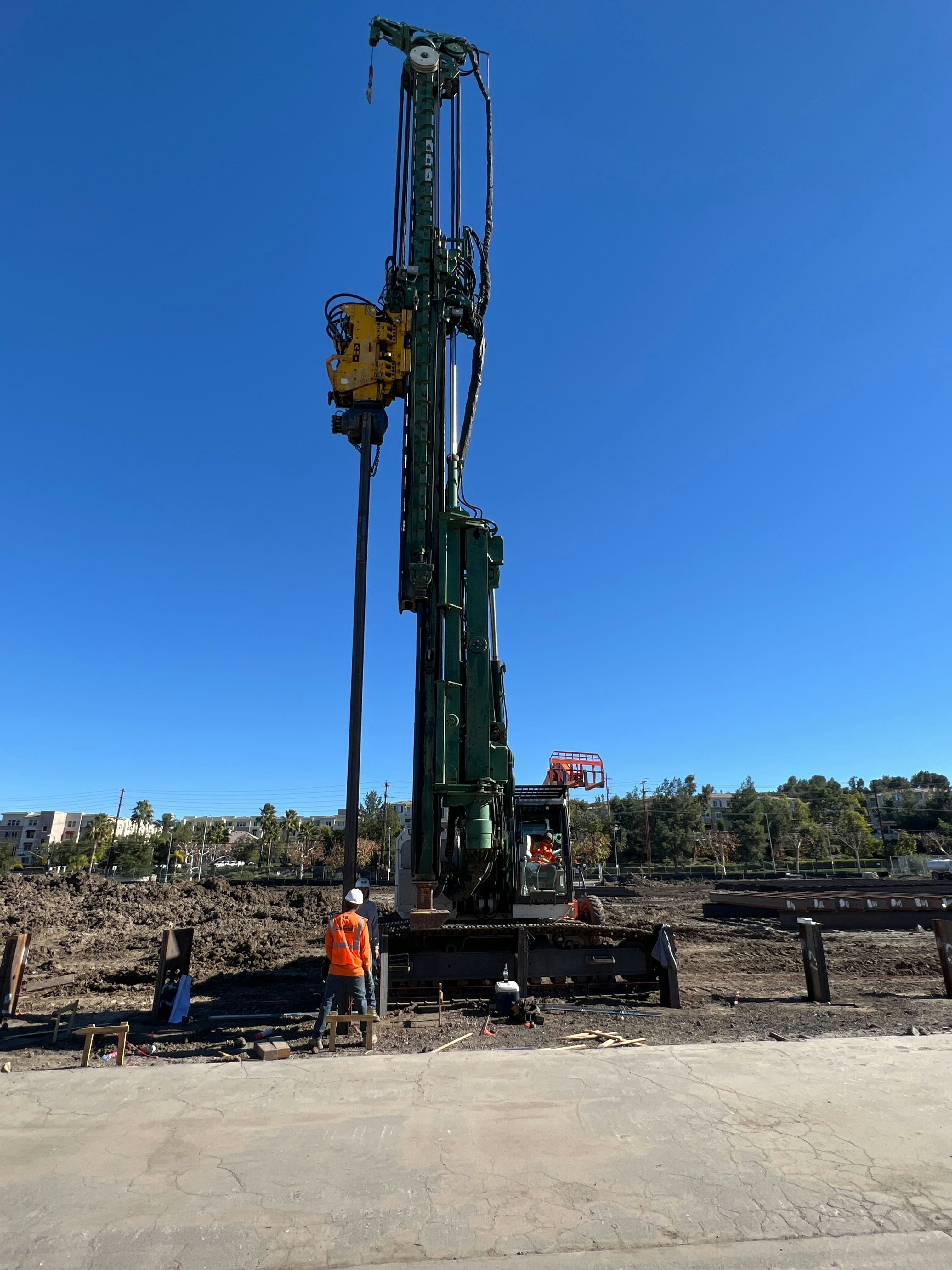
Hollow-stem auger and rotary core rigs advance through every horizon. SPT N-values are recorded at 1.0 m intervals. Disturbed and undisturbed samples are sealed, labelled, and logged in real time. Nothing leaves the borehole without a record.
Depth: 7.4 m bgl
blows/300mm
Every metre
photographed and logged.
Made Ground / Fill
Mixed demolition debris, brick fragments
Firm Brown Clay
Soft to firm, plasticity index 28–35%
Dense Gravel & Sand
Alluvial origin, angular–subangular clasts
Weathered Sandstone
Moderately strong, RQD 61–74%
Fresh Mudstone Bedrock
Strong, UCS 45–60 MPa, suitable for piled foundation termination
Raw data.
No interpretation yet.
Samples go to UKAS-accredited laboratories. Particle size distribution, Atterberg limits, triaxial shear strength, and chemical contamination suites run in parallel. Results are returned within 5–10 working days.
| Test | Depth | Result |
|---|---|---|
| PSD — Gravel % | 4.2 m | 68% |
| PSD — Sand % | 4.2 m | 24% |
| Liquid Limit | 2.6 m | 42% |
| Plastic Limit | 2.6 m | 19% |
| UCS (MPa) | 9.4 m | 48.2 |
| RQD | 9.0–12.5 m | 88% |
| TPH (mg/kg) | 0.8 m | <50 |
| Sulphate (SO₄) | 2.0 m | 0.3 g/l |
Foundation recommendations
you can build on.
The Geotechnical Interpretive Report translates raw data into design parameters. Bearing capacity, settlement estimates, pile toe levels, and slope stability factors of safety — stated with the precision your structural engineer needs.
Bored piles ∅600 mm to 11.5 m bgl
Terminating in fresh mudstone. Characteristic bearing resistance: 2,800 kN/pile.
250 kPa at 1.5 m depth
Dense gravel stratum. Settlement < 25 mm at SLS loading.
FoS = 1.62 (drained)
Acceptable per BS EN 1997-1. No remedial earthworks required.
Category 1 — Suitable for Use
TPH and heavy metals below SGVs for commercial end-use.
A report your structural
engineer can sign off on.
Every Stratum report includes a factual log, laboratory data appendix, and a separate interpretive section with foundation recommendations, bearing capacity values, and settlement estimates — formatted to Eurocode 7 and NHBC Chapter 4 requirements.
5–10 days
Lab turnaround
UKAS accredited
250 kPa
Typical bearing pressure
Dense gravel stratum
88%
Peak RQD achieved
Fresh mudstone BH-02
<25 mm
Settlement guarantee
At SLS loading
Get a Site Assessment
Tell us where and what. We will scope the investigation, quote within 48 hours, and mobilise within 10 working days of instruction.
Free Borehole
Spacing Guide
A 12-page technical reference covering Eurocode 7 exploration grid requirements, minimum borehole numbers by structure type, and depth rules for piled and spread foundations.
400+
Sites investigated
14 yrs
In the field
UKAS
Accredited labs